£59.00

It has never been this cheap. We have no record of a lower price.

£59 today · cheaper than every other day in the last 3 months

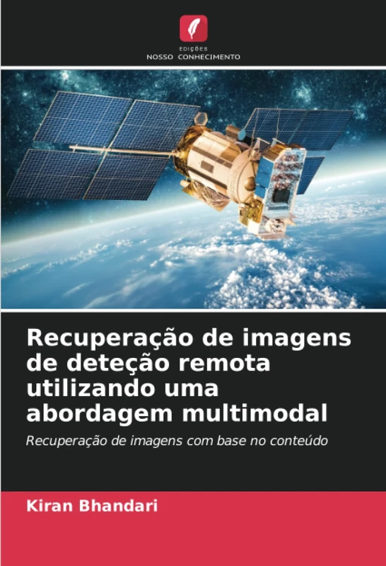
Recuperação de imagens de deteção remota utilizando uma abordagem multimodal: Recuperação de imagens com base no conteúdo

View at Amazon

Price History & Forecast

Grey patches = out of stock. Cheaper = lower on the chart. Hover for exact prices.

Last 54 days · 54 data points (no recent data)

Historical
Generating forecast…
£59.00 £56.05 £57.23 £58.41 £59.59 £60.77 £61.95 23 July 2026 05 August 2026 18 August 2026 31 August 2026 14 September 2026
View at Amazon ↗

Price data last checked 37 day(s) ago - refreshing...

NEW HERE?

Amazon shows you one price. We show you all of them.

Tosheroon watches Amazon prices so you don't have to. Every product on Amazon has a price history — we make it visible. Set the price you'd actually pay, and we'll email you the second it gets there. No app, no account, one email.

WHAT'S ON THIS PAGE

↑ Price chart
when this has been cheap or pricey
↑ Forecast
where the price is heading next
↓ Statistics
all-time high & low, recent range
↑ Price alert
name your number, we'll email you

Price Distribution

Price distribution over 54 days • 1 price levels

Days at Price
54 days 0 14 27 41 54 £59 Days at Price

Price Analysis

Most common price: £59 (54 days, 100.0%)

Price range: £59 - £59

Price levels: 1 different prices over 54 days

Description

Com os avanços na tecnologia de sensores de imagem espacial, o potencial de construção de bases de dados geoespaciais aumentou imenso; no entanto, a extração de informações sobre alvos a partir de imagens de alta resolução obtidas por teledeteção continua a ser um problema difícil. Foram lançados muitos satélites para analisar diferentes regiões do terreno, como desertos, zonas costeiras, áreas metropolitanas, vegetação, para efetuar levantamentos geológicos para monitorização ambiental, previsão de catástrofes, etc. Estes satélites adquirem um grande número de imagens todos os dias, o que leva a um aumento exponencial da base de dados que contém imagens de satélite não estruturadas e não organizadas. Assim, há uma necessidade iminente de desenvolver um sistema robusto para recuperar um conjunto de imagens desta base de dados não estruturada que satisfaça os requisitos do utilizador. Os sistemas convencionais de processamento de consultas baseiam-se na correspondência de palavras-chave, como a hora de aquisição, as localizações geográficas, os tipos de sensores, etc. O conjunto de dados padrão disponível em www.earthexplore.nasa.us.gov.in/images, que contém 1000 imagens, é utilizado para levar a cabo a investigação. Em cada fase do trabalho, é efectuada uma análise comparativa pormenorizada dos resultados recuperados em termos de exatidão, precisão, recuperação e medida F.

Product Specifications

Format
paperback
Domain
Amazon UK
Release Date
23 August 2023
Listed Since
24 August 2023

Barcode

No barcode data available

Similar Products You Might Like

Garantir a segurança alimentar a nível mundial: Deteção remota e SIG, ferramentas essenciais para uma gestão sustentável das terras

78% match

Garantir a segurança alimentar a nível mundial: Deteção remota e SIG, ferramentas essenciais para uma gestão sustentável das terras

£66.99 15 Sep 2026
Improving Infrared-Based Precipitation Retrieval Algorithms Using Multi-Spectral Satellite Imagery (Springer Theses)
77% match

Improving Infrared-Based Precipitation Retrieval Algorithms Using Multi-Spectral Satellite Imagery (Springer Theses)

Springer

£73.27 15 Sep 2026
Learning to Understand Remote Sensing Images
77% match

Learning to Understand Remote Sensing Images

MDPI AG

£64.84 15 Sep 2026
Télédétection et analyse géospatiale: Télédétection
76% match

Télédétection et analyse géospatiale: Télédétection

£69.99 15 Sep 2026
Content-Based Image Retrieval: Ideas, Influences, and Current Trends
75% match

Content-Based Image Retrieval: Ideas, Influences, and Current Trends

Springer

£77.33 12 Aug 2026
Optical Remote Sensing: Advances in Signal Processing and Exploitation Techniques: 3 (Augmented Vision and Reality, 3)
75% match

Optical Remote Sensing: Advances in Signal Processing and Exploitation Techniques: 3 (Augmented Vision and Reality, 3)

Springer

£108.01 08 Aug 2026
Deep Cognitive Modelling in Remote Sensing Image Processing

75% match

Deep Cognitive Modelling in Remote Sensing Image Processing

£342.00 09 Sep 2026
Visão por computador baseada na tecnologia de aprendizagem automática: monografia

75% match

Visão por computador baseada na tecnologia de aprendizagem automática: monografia

£86.00 14 Sep 2026
Remote Sensing from Space: Supporting International Peace and Security
75% match

Remote Sensing from Space: Supporting International Peace and Security

Springer

£111.56 17 Oct 2026
Segmentação de Página em Coleções de Imagens de Documentos Amáricos

75% match

Segmentação de Página em Coleções de Imagens de Documentos Amáricos

£47.00 14 Sep 2026
UAV‐Based Remote Sensing: Volume 2
75% match

UAV‐Based Remote Sensing: Volume 2

MDPI AG

£64.85 15 Sep 2026
Computer Processing of Remotely-Sensed Images
75% match

Computer Processing of Remotely-Sensed Images

Wiley

£76.08 07 Aug 2026
Super-Resolução de imagem: Um guia completo: Super-resolução de imagem única e suas aplicações
75% match

Super-Resolução de imagem: Um guia completo: Super-resolução de imagem única e suas aplicações

£59.00 16 Sep 2026
Intelligent Image Databases: Towards Advanced Image Retrieval: 421 (The Springer International Series in Engineering and Computer Science, 421)
75% match

Intelligent Image Databases: Towards Advanced Image Retrieval: 421 (The Springer International Series in Engineering and Computer Science, 421)

Springer
£72.75 14 Sep 2026
Big Data for Remote Sensing: Visualization, Analysis and Interpretation: Digital Earth and Smart Earth
74% match

Big Data for Remote Sensing: Visualization, Analysis and Interpretation: Digital Earth and Smart Earth

Springer

£106.87 17 Oct 2026
Earth Science Satellite Applications: Current and Future Prospects (Springer Remote Sensing/Photogrammetry)
74% match

Earth Science Satellite Applications: Current and Future Prospects (Springer Remote Sensing/Photogrammetry)

Springer

£108.01 07 Aug 2026
Space Optical Remote Sensing: Fundamentals and System Design (Advances in Optics and Optoelectronics)
74% match

Space Optical Remote Sensing: Fundamentals and System Design (Advances in Optics and Optoelectronics)

Springer

£80.67 13 Sep 2026
Mathematical Models for Remote Sensing Image Processing: Models and Methods for the Analysis of 2D Satellite and Aerial Images (Signals and Communication Technology)
74% match

Mathematical Models for Remote Sensing Image Processing: Models and Methods for the Analysis of 2D Satellite and Aerial Images (Signals and Communication Technology)

Springer

£120.67 05 Aug 2026
Theory and Approach of Information Retrievals from Electromagnetic Scattering and Remote Sensing
74% match

Theory and Approach of Information Retrievals from Electromagnetic Scattering and Remote Sensing

Springer

£74.46 12 Sep 2026
Big Data for Remote Sensing: Visualization, Analysis and Interpretation: Digital Earth and Smart Earth
74% match

Big Data for Remote Sensing: Visualization, Analysis and Interpretation: Digital Earth and Smart Earth

Springer

£107.85 31 Aug 2026
Remote Sensing with Imaging Radar (Signals and Communication Technology)
74% match

Remote Sensing with Imaging Radar (Signals and Communication Technology)

Springer

£105.24 06 Aug 2026
Modelação Geo-espacial Ecológica para a Protecção das Águas Superficiais: Utilizando Sensoriamento Remoto & Técnicas GIS

74% match

Modelação Geo-espacial Ecológica para a Protecção das Águas Superficiais: Utilizando Sensoriamento Remoto & Técnicas GIS

£64.00 10 Sep 2026
Geospatial Technology for Earth Observation
74% match

Geospatial Technology for Earth Observation

Springer

£109.08 18 Aug 2026
Kernel Methods for Remote Sensing Data Analysis
74% match

Kernel Methods for Remote Sensing Data Analysis

Wiley

£80.35 06 Aug 2026