£102.00

It has never been this cheap. We have no record of a lower price.

£102 today · cheaper than every other day in the last 3 months

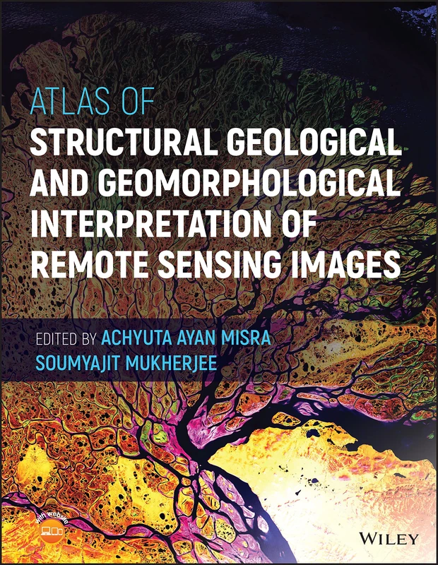
Wiley Atlas of Structural Geological and Geomorphological Interpretation of Remote Sensing Images

View at Amazon

Price History & Forecast

Grey patches = out of stock. Cheaper = lower on the chart. Hover for exact prices.

Last 65 days · 65 data points (no recent data)

Historical
Generating forecast…
£104.97 £101.70 £102.42 £103.13 £103.84 £104.55 £105.27 28 July 2026 13 August 2026 29 August 2026 14 September 2026 30 September 2026
View at Amazon ↗

Price data last checked 26 day(s) ago - will refresh soon

NEW HERE?

Amazon shows you one price. We show you all of them.

Tosheroon watches Amazon prices so you don't have to. Every product on Amazon has a price history — we make it visible. Set the price you'd actually pay, and we'll email you the second it gets there. No app, no account, one email.

WHAT'S ON THIS PAGE

↑ Price chart
when this has been cheap or pricey
↑ Forecast
where the price is heading next
↓ Statistics
all-time high & low, recent range
↑ Price alert
name your number, we'll email you

Price Distribution

Price distribution over 65 days • 2 price levels

Days at Price
Current Price
40 days · current 25 days 0 10 20 30 40 £102 £105 Days at Price

Price Analysis

Most common price: £102 (40 days, 61.5%)

Price range: £102 - £105

Price levels: 2 different prices over 65 days

Description

ATLAS OF STRUCTURAL GEOLOGICAL AND GEOMORPHOLOGICAL INTERPRETATION OF REMOTE SENSING IMAGES An extensive compilation of case studies in structural geology and geomorphology for interpreting remotely sensed images In the Atlas of Structural Geological and Geomorphological Interpretation of Remote Sensing Images, a team of experts delivers an extensive collection of over 20 different examples of structural geological and geomorphological studies by remote sensing. The book demonstrates how to properly interpret geological features and gather robust and reliable information from remote sensing images. This atlas contains high-quality colour images that depict a diversity of structures and geomorphic features from different tectonic regimes and geographic localities in the Americas, Europe, and Australasia. While its primary emphasis is on structural geology, geomorphology is considered in some depth as well. The examples also cover geological hazards, including volcanic eruptions and earthquakes. Readers will also find: A thorough introduction to the background of remote sensing, including foundational concepts and the classification of remote sensing based on data type, source, platform and imaging media Comprehensive discussions of geomorphology, including explorations of lava fissures, badlands and beaches In-depth explorations of structural geology, including discussions of deformation bands, fault lines and earthquake effects Several examples of how to trace hydrological processes such as glacier retreat, changes in drainage patterns and bar formation Perfect for advanced students and researchers in the geoscience community, Atlas of Structural Geological and Geomorphological Interpretation of Remote Sensing Images will also earn a place in the libraries of practicing professionals with an interest in the interpretation of remote sensing images.

Product Specifications

Brand
Wiley
Format
hardcover
Domain
Amazon UK
Release Date
17 November 2022
Listed Since
07 July 2022

Barcode

No barcode data available

Similar Products You Might Like
Structural Geological Atlas
97% match

Structural Geological Atlas

Springer

£121.90 23 Sep 2026
97% match

Structural Geology of Rocks and Regions

Wiley

£105.95 30 Sep 2026
97% match

Remote Sensing for Earth and Planetary Science

Wiley

£150.00 02 Oct 2026
Elements of Structural Geology (Routledge Revivals)
97% match

Elements of Structural Geology (Routledge Revivals)

Routledge

£91.99 30 Sep 2026
Re-envisioning Advances in Remote Sensing: Urbanization, Disasters and Planning
97% match

Re-envisioning Advances in Remote Sensing: Urbanization, Disasters and Planning

CRC Press

£135.81 30 Sep 2026
Structural Geology &Basic Methods Pkg
97% match

Structural Geology &Basic Methods Pkg

PEARSON EDUCATION

Price unavailable
John Wiley & Sons Sustainable Development Geospatial Book
97% match

John Wiley & Sons Sustainable Development Geospatial Book

Wiley
£188.95 02 Oct 2026
Text Book of Remote Sensing and Geographical Information Systems
97% match

Text Book of Remote Sensing and Geographical Information Systems

MTG
£107.14 03 Oct 2026
Supervised Learning in Remote Sensing and Geospatial Science
97% match

Supervised Learning in Remote Sensing and Geospatial Science

Elsevier
£113.69 05 Sep 2026
Active Seismic Tomography: Theory and Applications
97% match

Active Seismic Tomography: Theory and Applications

Wiley

£88.58 19 Sep 2026
Structural Geology
97% match

Structural Geology

Toronto Academic Press
£77.67 26 Sep 2026
Physical Geology: Earth Revealed
97% match

Physical Geology: Earth Revealed

McGraw-Hill Education
£82.99 30 Sep 2026
Geospatial and Hydrological Modelling for Sustainable Land and Water Management (Urban Remote Sensing for Energy and Environmental Sustainability)
97% match

Geospatial and Hydrological Modelling for Sustainable Land and Water Management (Urban Remote Sensing for Energy and Environmental Sustainability)

CRC Press
£130.00 11 Sep 2026
Remote Sensing and Geographical Information Systems: Environment Risk Prediction and Safety (Natural Disaster Research, Prediction and Mitigation)
97% match

Remote Sensing and Geographical Information Systems: Environment Risk Prediction and Safety (Natural Disaster Research, Prediction and Mitigation)

£172.99 24 Sep 2026
GNSS Monitoring of the Terrestrial Environment: Earthquakes, Volcanoes and Climate Change
97% match

GNSS Monitoring of the Terrestrial Environment: Earthquakes, Volcanoes and Climate Change

Elsevier
£100.38 03 Sep 2026
Geospatial Information and Services for Climate Resilient Disaster Management
97% match

Geospatial Information and Services for Climate Resilient Disaster Management

Elsevier

£106.67 18 Sep 2026
Geospatial Science for Smart Land Management: An Asian Context
97% match

Geospatial Science for Smart Land Management: An Asian Context

CRC Press
£61.77 30 Sep 2026
Landslide Science: Geospatial Advances in Monitoring, Modeling, and Management
97% match

Landslide Science: Geospatial Advances in Monitoring, Modeling, and Management

Elsevier
£117.99 23 Sep 2026
Remote Sensing and Image Processing in Mineralogy
97% match

Remote Sensing and Image Processing in Mineralogy

CRC Press
£69.97 10 Sep 2026
Remote Sensing and Image Processing in Mineralogy
97% match

Remote Sensing and Image Processing in Mineralogy

CRC Press

£183.48 02 Oct 2026
Towards AI Large Model: Remote Sensing Image Intelligent Interpretation and Application
97% match

Towards AI Large Model: Remote Sensing Image Intelligent Interpretation and Application

Springer
£149.99 24 Sep 2026
Principles of Engineering Geology and Geotechnics
97% match

Principles of Engineering Geology and Geotechnics

McGraw-Hill Education

£53.95 01 Oct 2026
Geological Engineering: Exploration and Management
97% match

Geological Engineering: Exploration and Management

Syrawood Publishing House

£71.12 24 Sep 2026
97% match

Remote Sensing and GIS: Space Technology and Machine Learning for Agricultural and Landscape Analytics

Wiley

£171.00 05 Sep 2026