£121.43

It has never been this cheap. We have no record of a lower price.

£121 today · cheaper than every other day in the last 3 months

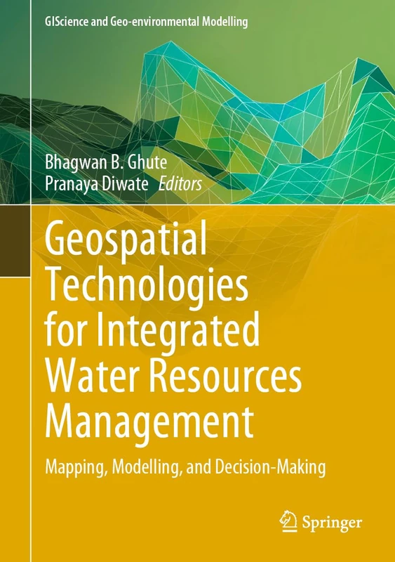
Springer Geospatial Technologies for Integrated Water Resources Management: Mapping, Modelling, and Decision-Making (GIScience and Geo-environmental Modelling)

View at Amazon

Price History & Forecast

Grey patches = out of stock. Cheaper = lower on the chart. Hover for exact prices.

Last 64 days · 64 data points (no recent data)

Historical
Generating forecast…
£121.44 £115.36 £117.79 £120.22 £122.65 £125.08 £127.51 22 August 2026 06 September 2026 22 September 2026 08 October 2026 24 October 2026
View at Amazon ↗

Price data last checked 27 day(s) ago - will refresh soon

NEW HERE?

Amazon shows you one price. We show you all of them.

Tosheroon watches Amazon prices so you don't have to. Every product on Amazon has a price history — we make it visible. Set the price you'd actually pay, and we'll email you the second it gets there. No app, no account, one email.

WHAT'S ON THIS PAGE

↑ Price chart
when this has been cheap or pricey
↑ Forecast
where the price is heading next
↓ Statistics
all-time high & low, recent range
↑ Price alert
name your number, we'll email you

Price Distribution

Price distribution over 64 days • 1 price levels

Days at Price
64 days 0 16 32 48 64 £121 Days at Price

Price Analysis

Most common price: £121 (64 days, 100.0%)

Price range: £121 - £121

Price levels: 1 different prices over 64 days

Description

This book examines water resources, helps understand complexities in water management, and explains the use of geospatial technology. By 2050, the world will have nearly about 9.8 billion population and which is almost 2.5 to 3 billion added to the present population. Only 3% of world water resources are available for human consumption. Even some resources are polluted because of poor management. Water management is important since it helps determine future irrigation prospects. Management of water resources under set policies and regulations. Water is a more valuable commodity and the world is facing acute water shortages because of drought which is attributed to climate change and overuse. Many rivers are drying up, polluted and encroached. Now the challenge is whether future generations will have enough fresh water for living. Geospatial Technology i.e. Remote Sensing (RS) and GIS have gained considerable interest among earth and hydrological science communities for solving and understanding various complex issues and approaches towards water resources development and management. Water can provide sustainability to any region. Sustainability means that meet the needs of the present, without compromising the ability of future generations to meet their own needs. These are generally integrated to study a variety of natural resources and their characteristics. Major advancements have been accomplished in integrating remote sensing and GIS and they complement each other. RS is used for acquiring information for GIS. Remote sensing and GIS integration provide information on the spatial variation, extent, and potential and limitations of natural resources, which is essential for planning the strategy for sustainable development. Most hydrological or geomorphological models are developed in a GIS framework and these are helpful for the planning and management of water and decision-makers for sustainable development.

Product Specifications

Format
hardcover
Domain
Amazon UK
Release Date
17 July 2024
Listed Since
08 March 2024

Barcode

No barcode data available

Similar Products You Might Like
Remote Sensing, GIS and Modelling for Water Resource Management: Volume 2 (Springer Water)
93% match

Remote Sensing, GIS and Modelling for Water Resource Management: Volume 2 (Springer Water)

Springer
£139.77 13 Nov 2026
Geospatial Practices in Natural Resources Management (Environmental Science and Engineering)
93% match

Geospatial Practices in Natural Resources Management (Environmental Science and Engineering)

Springer

£115.59 22 Oct 2026
Damming and Wetland Eco-hydrology: Evaluation, Resilience and Restoration (GIScience and Geo-environmental Modelling)
93% match

Damming and Wetland Eco-hydrology: Evaluation, Resilience and Restoration (GIScience and Geo-environmental Modelling)

Springer

£139.64 28 Oct 2026
River Conservation and Water Resource Management (Advances in Geographical and Environmental Sciences)
92% match

River Conservation and Water Resource Management (Advances in Geographical and Environmental Sciences)

Springer
£106.68 20 Oct 2026
Geospatial Application of Coastal Hazards: Monitoring, Mitigation, Adaptation and Prediction (Springer Water)
92% match

Geospatial Application of Coastal Hazards: Monitoring, Mitigation, Adaptation and Prediction (Springer Water)

Springer
£131.16 23 Oct 2026
Geospatial Technologies for Resources Planning and Management: 115 (Water Science and Technology Library, 115)
92% match

Geospatial Technologies for Resources Planning and Management: 115 (Water Science and Technology Library, 115)

Springer
£120.84 30 Oct 2026
Geospatial Analytics for Environmental Pollution Modeling: Analysis, Control and Management
92% match

Geospatial Analytics for Environmental Pollution Modeling: Analysis, Control and Management

Springer

£92.42 08 Nov 2026
Environmental Risk and Resilience in the Changing World: Integrated Geospatial AI and Multidimensional Approach (GIScience and Geo-environmental Modelling)
92% match

Environmental Risk and Resilience in the Changing World: Integrated Geospatial AI and Multidimensional Approach (GIScience and Geo-environmental Modelling)

Springer
£127.59 22 Oct 2026
Revealing Ecosystem Services Through Geospatial Technologies: Beyond the Surface (Springer Remote Sensing/Photogrammetry)
91% match

Revealing Ecosystem Services Through Geospatial Technologies: Beyond the Surface (Springer Remote Sensing/Photogrammetry)

Springer
£121.12 20 Oct 2026
Geo-intelligence for Sustainable Development (Advances in Geographical and Environmental Sciences)
91% match

Geo-intelligence for Sustainable Development (Advances in Geographical and Environmental Sciences)

Springer
£113.76 31 Oct 2026
Monitoring and Managing Multi-hazards: A Multidisciplinary Approach (GIScience and Geo-environmental Modelling)
91% match

Monitoring and Managing Multi-hazards: A Multidisciplinary Approach (GIScience and Geo-environmental Modelling)

Springer

£115.72 22 Oct 2026
Water Management in Developing Countries and Sustainable Development (Water Resources Development and Management)
91% match

Water Management in Developing Countries and Sustainable Development (Water Resources Development and Management)

Springer
£103.27 21 Oct 2026
Advanced Geospatial Intelligence and AI for Environmental Resilience and Sustainable Development (Advances in Geographic Information Science)
91% match

Advanced Geospatial Intelligence and AI for Environmental Resilience and Sustainable Development (Advances in Geographic Information Science)

Springer

£130.70 21 Oct 2026
Blue-Green Land Management and Smart Ecosystem Services: Integrated Strategies for Planning and Development (Advances in Geographical and Environmental Sciences)
91% match

Blue-Green Land Management and Smart Ecosystem Services: Integrated Strategies for Planning and Development (Advances in Geographical and Environmental Sciences)

Springer

£121.98 20 Oct 2026
Sustainable Development of Water and Environment (Environmental Science and Engineering)
91% match

Sustainable Development of Water and Environment (Environmental Science and Engineering)

Springer
£112.25 20 Oct 2026
Geospatial Aspects of Managing the Development of Complex Systems (Earth and Environmental Sciences Library)
90% match

Geospatial Aspects of Managing the Development of Complex Systems (Earth and Environmental Sciences Library)

Springer
£121.64 20 Oct 2026
Remote Sensing for Characterization of Geohazards and Natural Resources (Springer Remote Sensing/Photogrammetry)
90% match

Remote Sensing for Characterization of Geohazards and Natural Resources (Springer Remote Sensing/Photogrammetry)

Springer
£103.65 19 Nov 2026
Geo-Data Revolution: Advances in Spatial Analysis and Natural Hazard Mapping (Advances in Geographic Information Science)
90% match

Geo-Data Revolution: Advances in Spatial Analysis and Natural Hazard Mapping (Advances in Geographic Information Science)

Springer
£128.72 10 Nov 2026
Tangible Modeling with Open Source GIS
90% match

Tangible Modeling with Open Source GIS

Springer
£92.22 01 Nov 2026
GeoComputational Analysis and Modeling of Regional Systems (Advances in Geographic Information Science)
90% match

GeoComputational Analysis and Modeling of Regional Systems (Advances in Geographic Information Science)

Springer
£112.57 22 Oct 2026
New Research in Crime Modeling and Mapping Using Geospatial Technologies (Geotechnologies and the Environment, 27)
90% match

New Research in Crime Modeling and Mapping Using Geospatial Technologies (Geotechnologies and the Environment, 27)

Springer
£199.98 10 Sep 2026
Hazard Modeling and Assessment of the Nile Delta Coast: Remote Sensing and GIS Applications
90% match

Hazard Modeling and Assessment of the Nile Delta Coast: Remote Sensing and GIS Applications

Springer

£100.11 08 Sep 2026
Hydrology and Urban Water Supply (Water and Wastewater Management)
90% match

Hydrology and Urban Water Supply (Water and Wastewater Management)

Springer

£154.99 20 Oct 2026
Resilient Water Management Strategies in Urban Settings: Innovations in Decentralized Water Infrastructure Systems (Springer Water)
90% match

Resilient Water Management Strategies in Urban Settings: Innovations in Decentralized Water Infrastructure Systems (Springer Water)

Springer

£113.77 24 Oct 2026